Die Karten des Rheinlaufs aus der Cosmographia von Sebastian Münster und die barocken, mit Fürstenkolorit und opulenten Titelkartuschen und Meilenanzeigern versehenen Karten des französischen Kartografen Alexis-Hubert Jaillot bilden den Schwerpunkt dieser Sonderausstellung.
Glanzpunkte sind die drei Tafeln der lateinischen Ausgabe der Cosmographia aus dem Jahre 1572; sie zeigen den Rheinlauf von der Quelle bis zur Mündung.
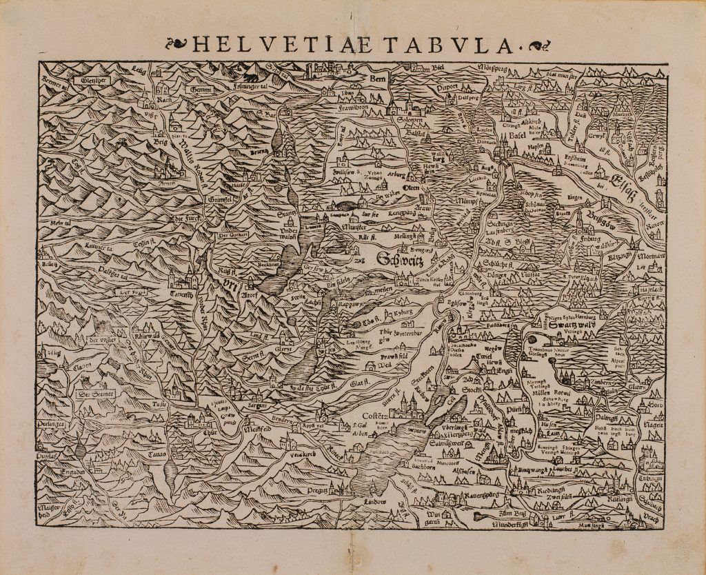
1572 Münster, Sebastian: Prima Rheni Tabvla Helvetia
Quelle – Rhinau

1572 Münster, Sebastian: Secunda Rheni Tabvla
Straßburg – Bad Breisig
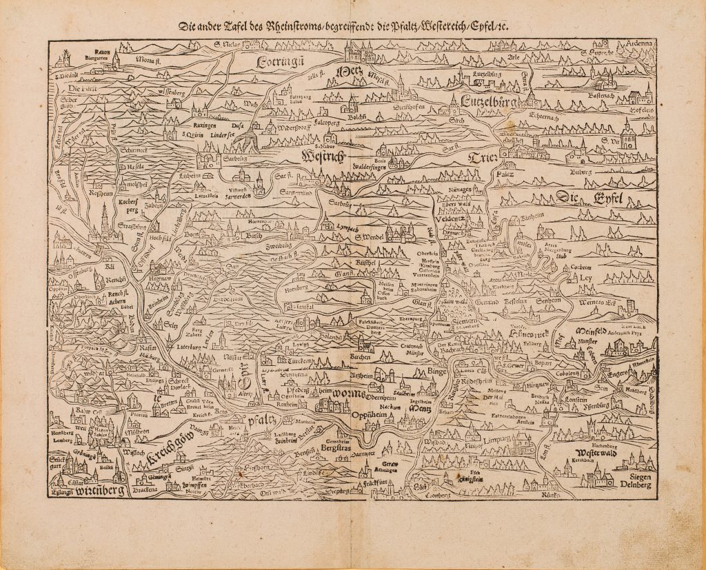
1578 Münster, Sebastian: Die ander Tafel des Rheinstroms, begreiffend die Pfaltz, Westereich, Eyfel etc
Straßburg – Bad Breisig
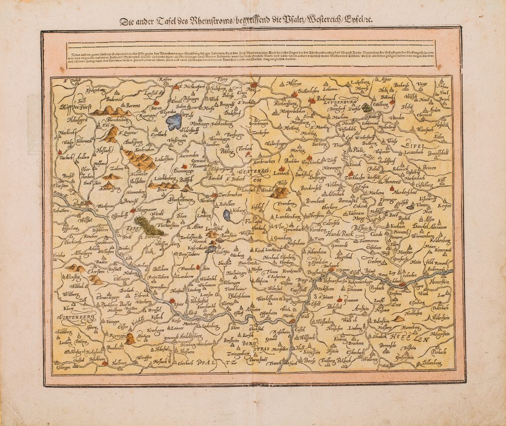
1628 Münster, Sebastian: Die ander Tafel des Rheinstroms, begreiffend die Pfaltz, Westereich, Eyfel etc.
Straßburg – Bad Breisig
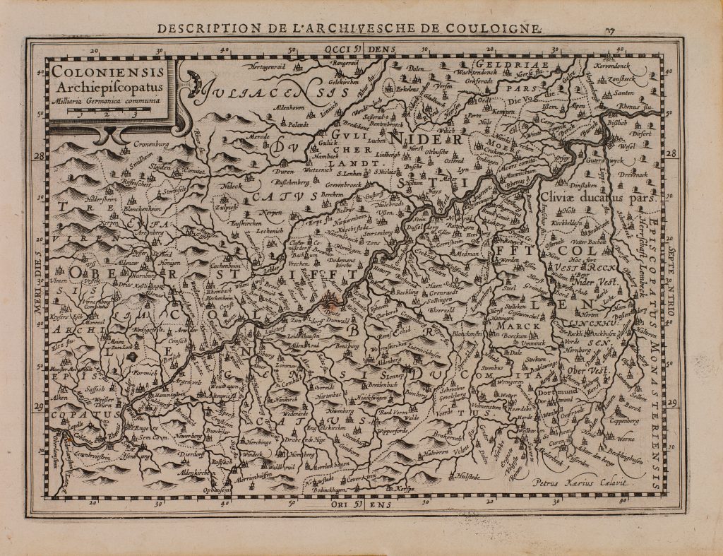
1630 Mercator, Gerhard: Coloniensis Archiepiscopatus
Oberlahnstein – Xanten
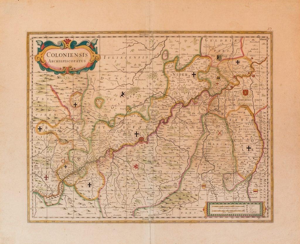
1683 Pitt, Moses: Coloniensis Archiepiscopatus
Oberlahnstein – Xanten
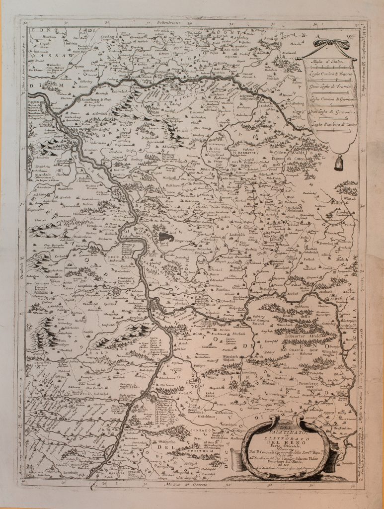
1690 Coronelli, Vincenzo: Del Palatinato, et Elettorato Del Reno Parte Orientale
Karlsruhe – Mainz

1691 Jaillot, Alexis-Hubert: La Basse Partie Du Cercle Du Haut-Rhein
Oberwesel – Köln
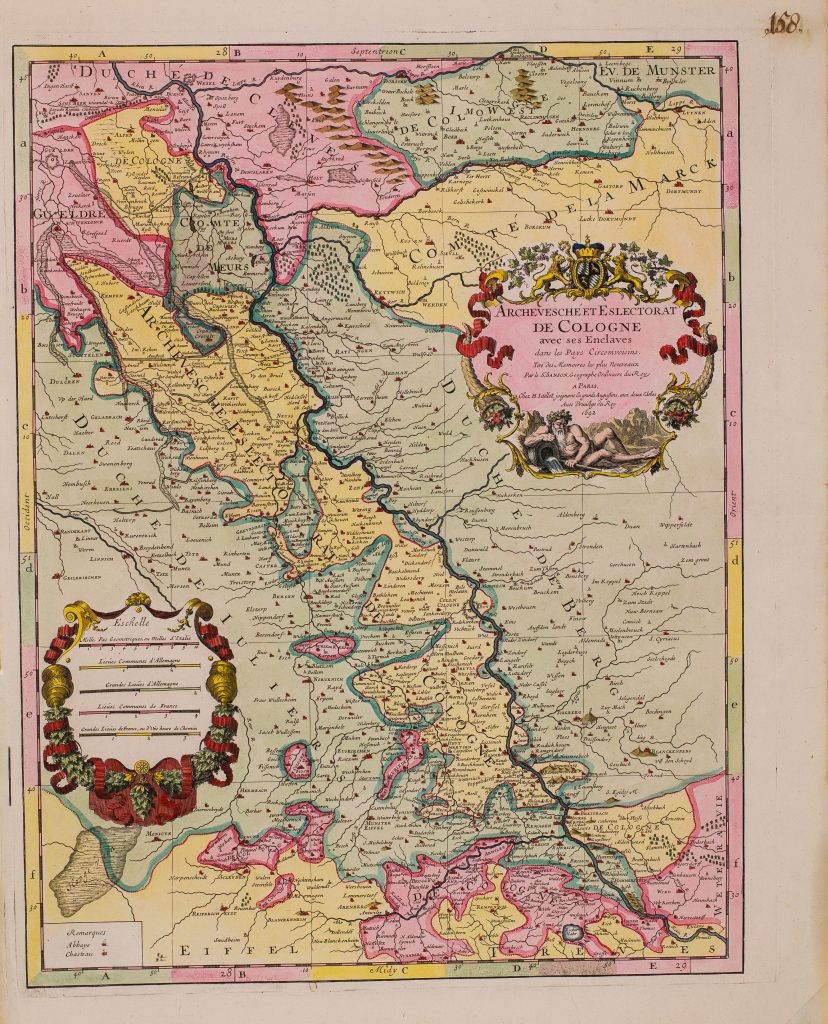
1692 Jaillot, Alexis-Hubert: Archevesché Et Eslectorat De Cologne
Engers – Xanten
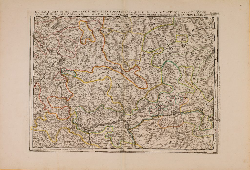
1692 Jaillot, Alexis-Hubert: DU HAUT RHIN ou sont L’ARCHEVESCHE et ELECTORAT de TREVES
Groß-Gerau – nördlich Andernach

1692 Jaillot, Alexis-Hubert: Partie Occidentale Du Palatinat et Eslectorat Du Rhein Le Duché De Simmeren
Frankenthal – Bad Salzig
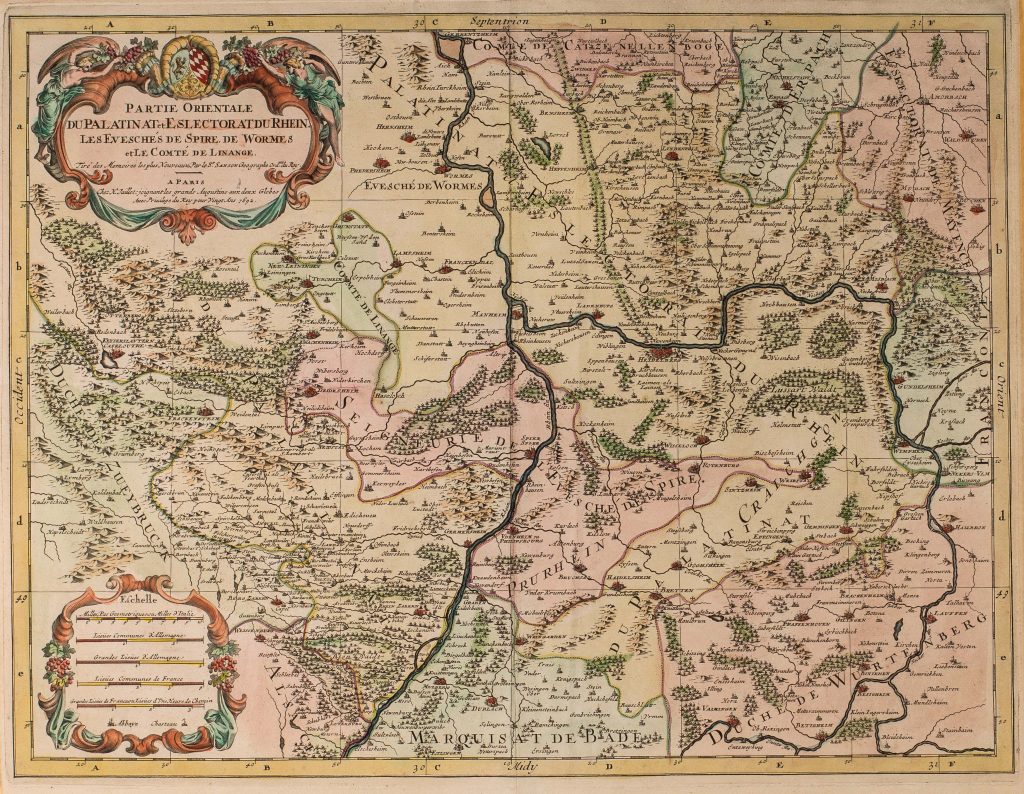
1692 Jaillot, Alexis-Hubert: Partie Orientale Du Palatinat et Eslectorat Du Rhein
Elchesheim-Illingen – Gernsheim
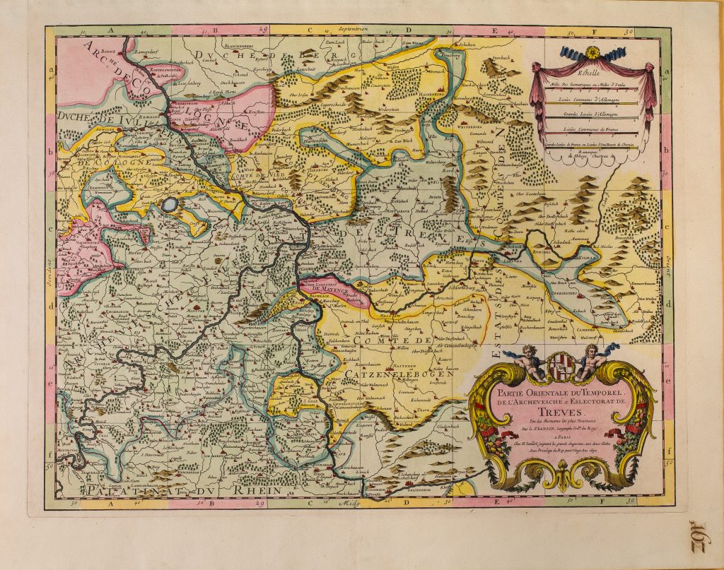
1692 Jaillot, Alexis-Hubert: PARTIE ORIENTALE DU TEMPOREL DE L’ARCHEVESCHE et ESLECTORAT DE TREVES
Erbach – Bonn
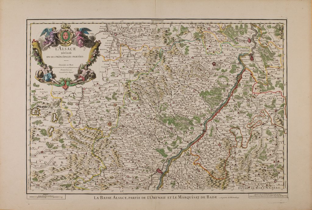
1695 Jaillot, Alexis-Hubert: La Basse Alsace, Partie De L’Ortnaw Et Le Marquisat De Bade et partie du Wirtenberg
Straßburg – Speyer
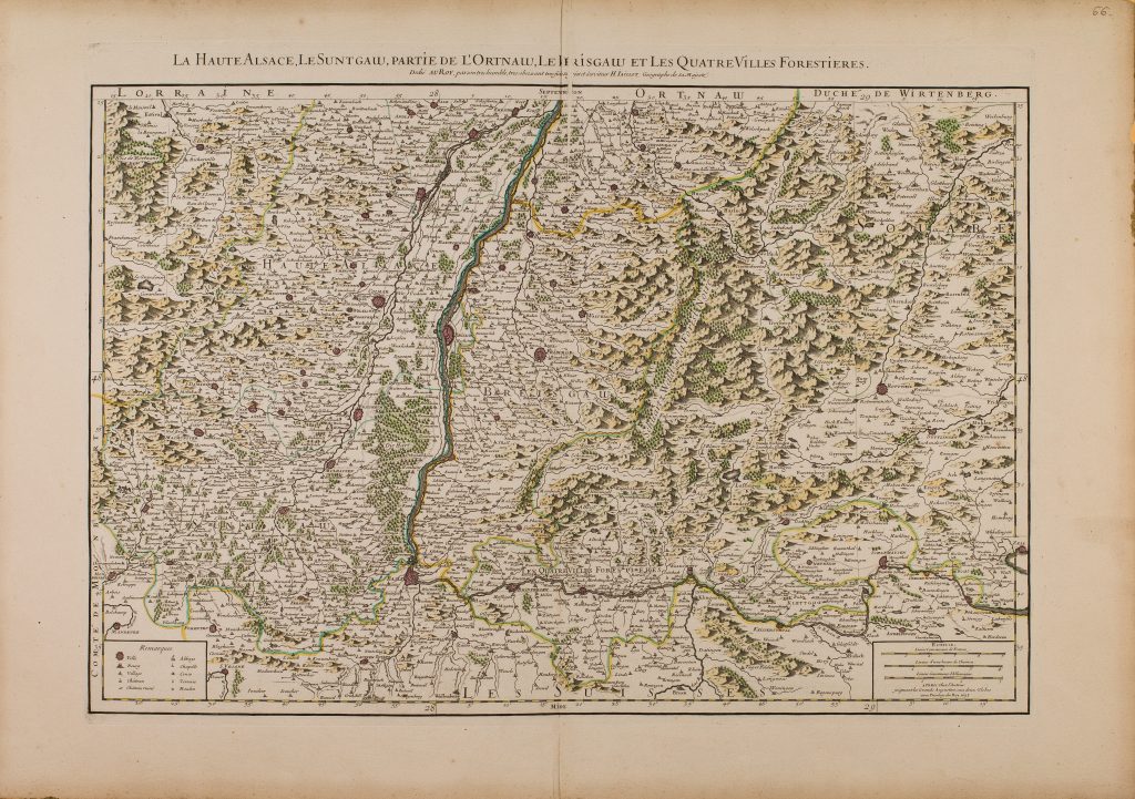
1695 Jaillot , Alexis-Hubert: La Haute Alsace, Le Suntgaw, Partie De L’Ortnaw, Le Brisgaw Et Les Quatre Villes Forestieres
Stein am Rhein – Schwanau
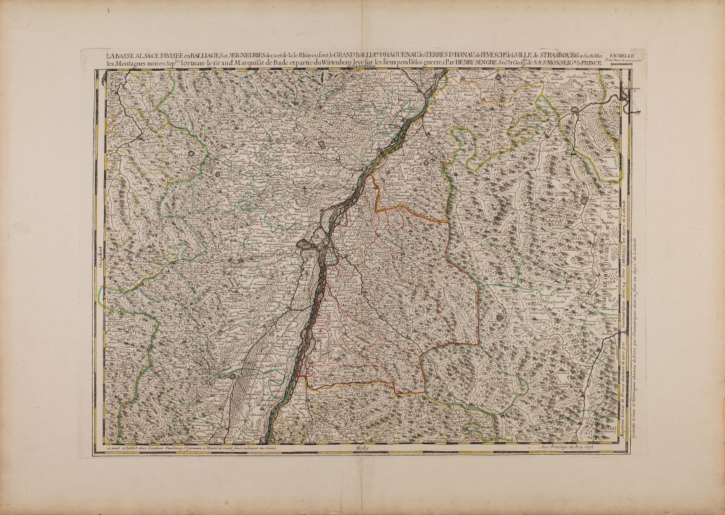
1695 Sengre, Henri: La Basse Alsace Divisée en Balliages et Seigneuries
Kaiserstuhl – Karlsruhe
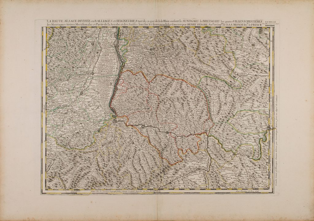
1695 Jaillot , Alexis-Hubert: LA HAUTE ALSACE DIVISEE en BALLIAGES et SEIGNEURIES
Schaffhausen – Breisach
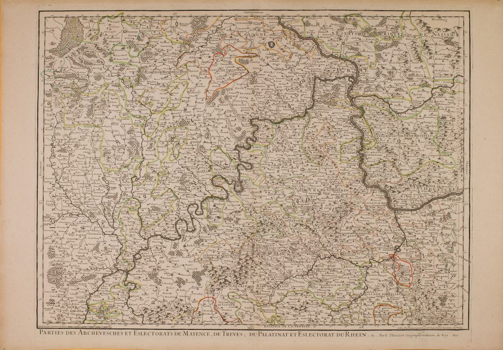
1696 Jaillot, Alexis-Hubert: Archeveschés et Esclectorats De Mayence, De Treves
Mainz – Bad Breisig
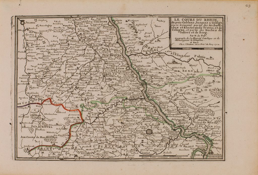
1702 Fer, Nicolas de: Le Cours Du Rhein, depuis Coblens Jusques a Cologne
Koblenz – Köln
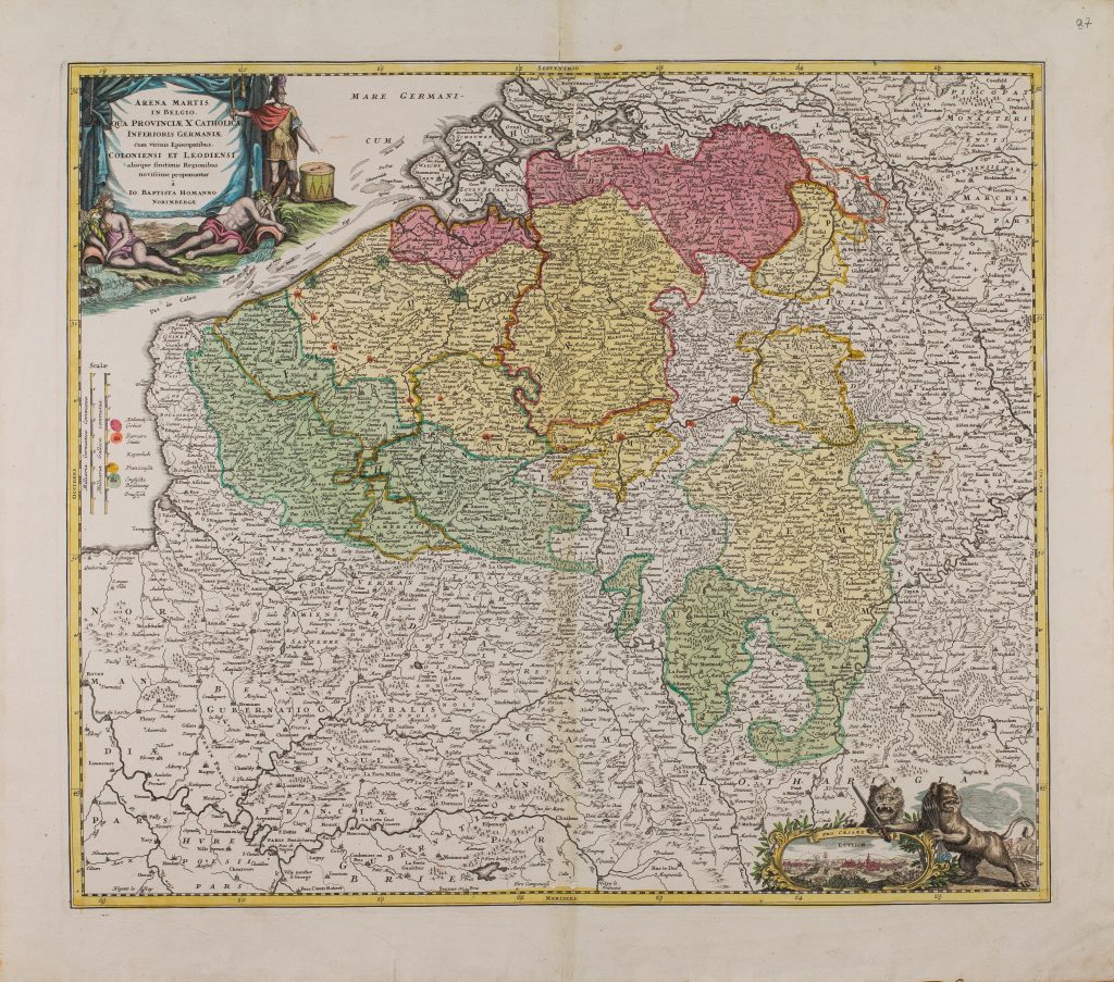
1702 Homann, Johann Baptist: Arena Martis in Belgico
Bad Breisig – Mündung
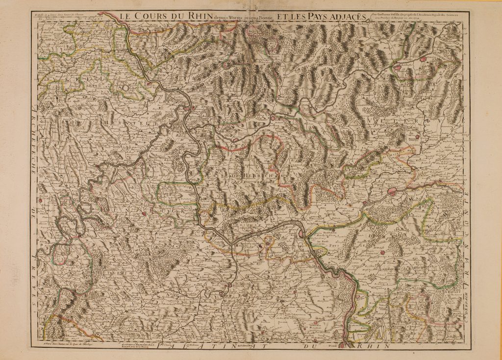
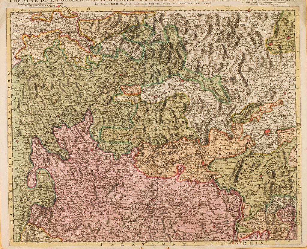
1704 Delisle , Guillaume: Le Cours Du Rhin depuis Worms jus qu’a Bonne
Worms – Bonn
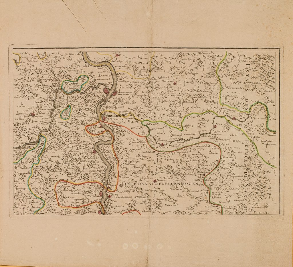
1705 Alexis-Hubert Jaillot: Carte Particuliere des pays qui sont situez entre le Rhein, la Saare, la Moselle et … (Blatt 2)
Oberwesel – Weißenthurm
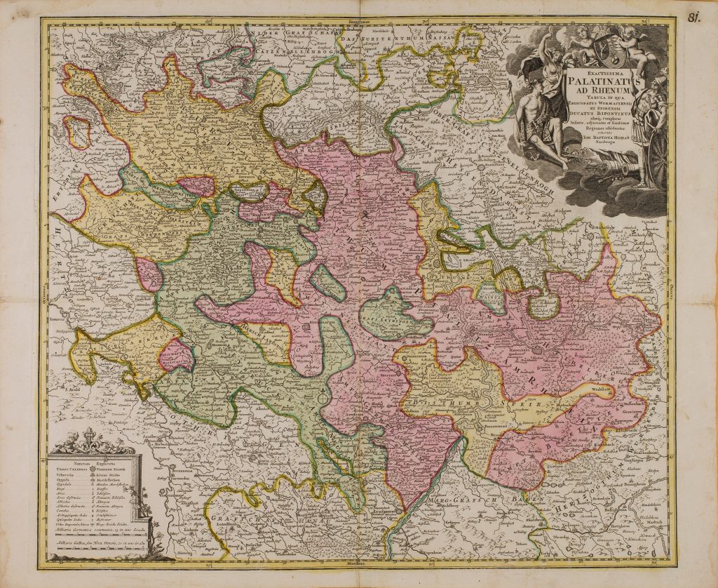
1712 Homann, Johann Baptist: Palatinatus Ad Rhenum
Rastatt – Bad Salzig
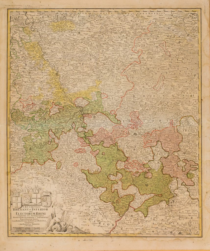
1716 Homann, Johann Baptist: Circulus Rhenanus Inferior
Fort-Louis –Wesel
1725 Delisle, Guillaume: Le Cours Du Rhin depuis Worms jus-qu’a Bonne
Worms – Bonn
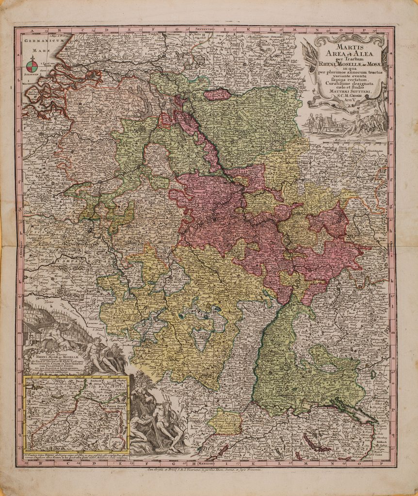
1731 Seutter, Matthäus: Martis Area et Alea per Tractum Rheni, Mosellae ac Mosae
Bodensee – Mündung
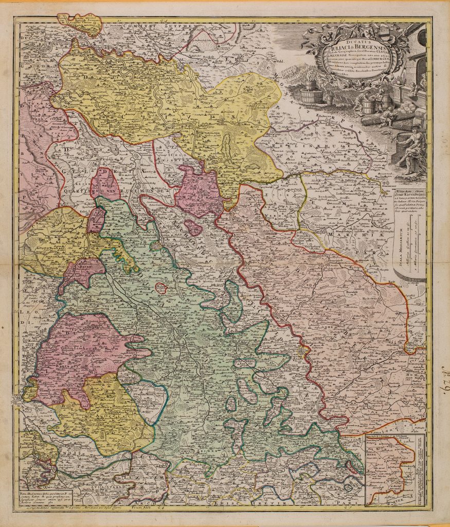
1739 Homann’s Erben: DUCATUS IULIACI & BERGENSIS Tabula Geographica
Andernach – Nijmegen
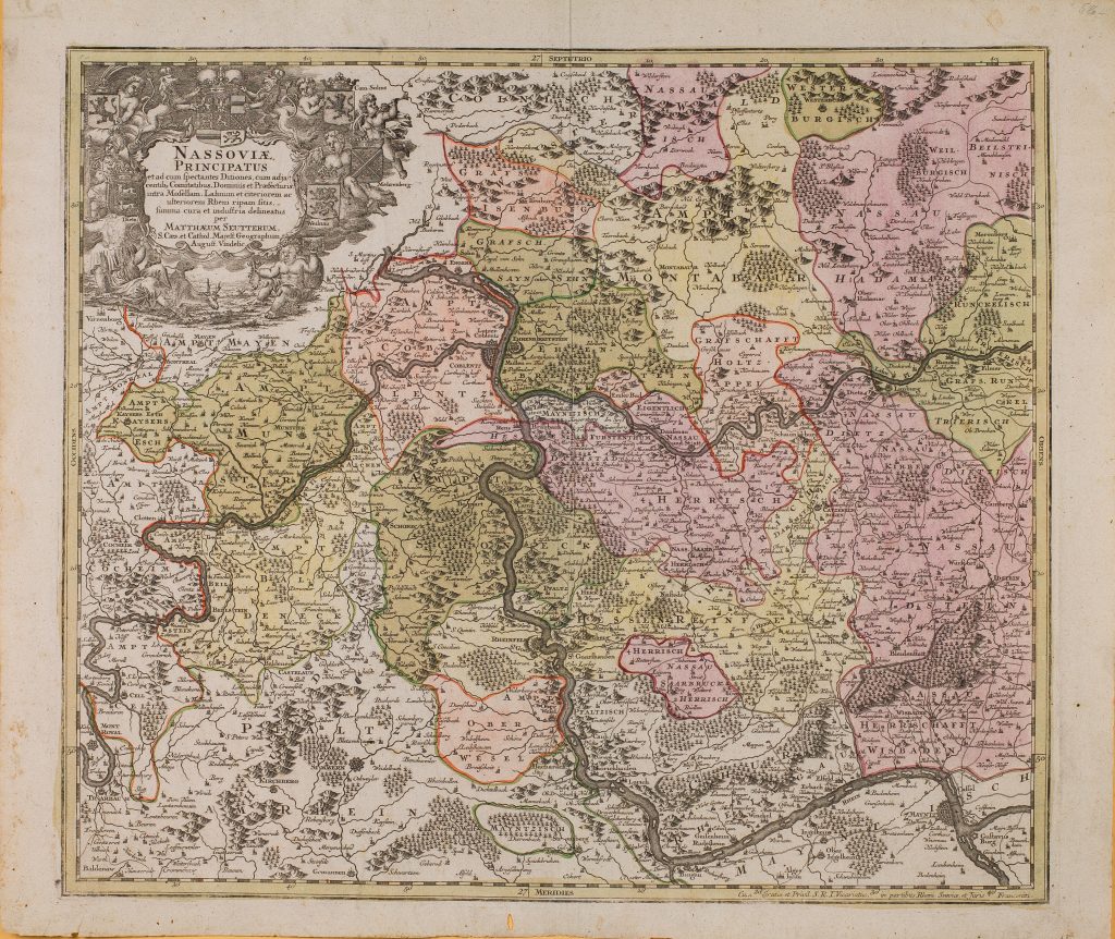
1740 Seutter, Matthäus: NASSOVIAE PRINCIPATUS
Ginsheim – Neuwied
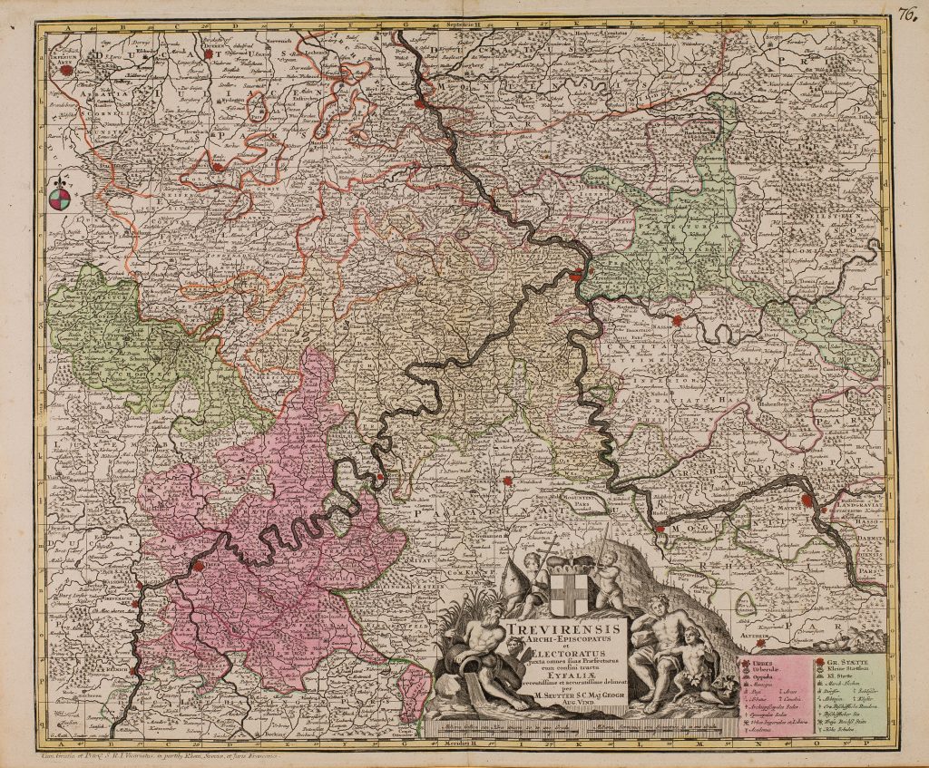
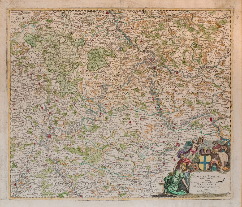
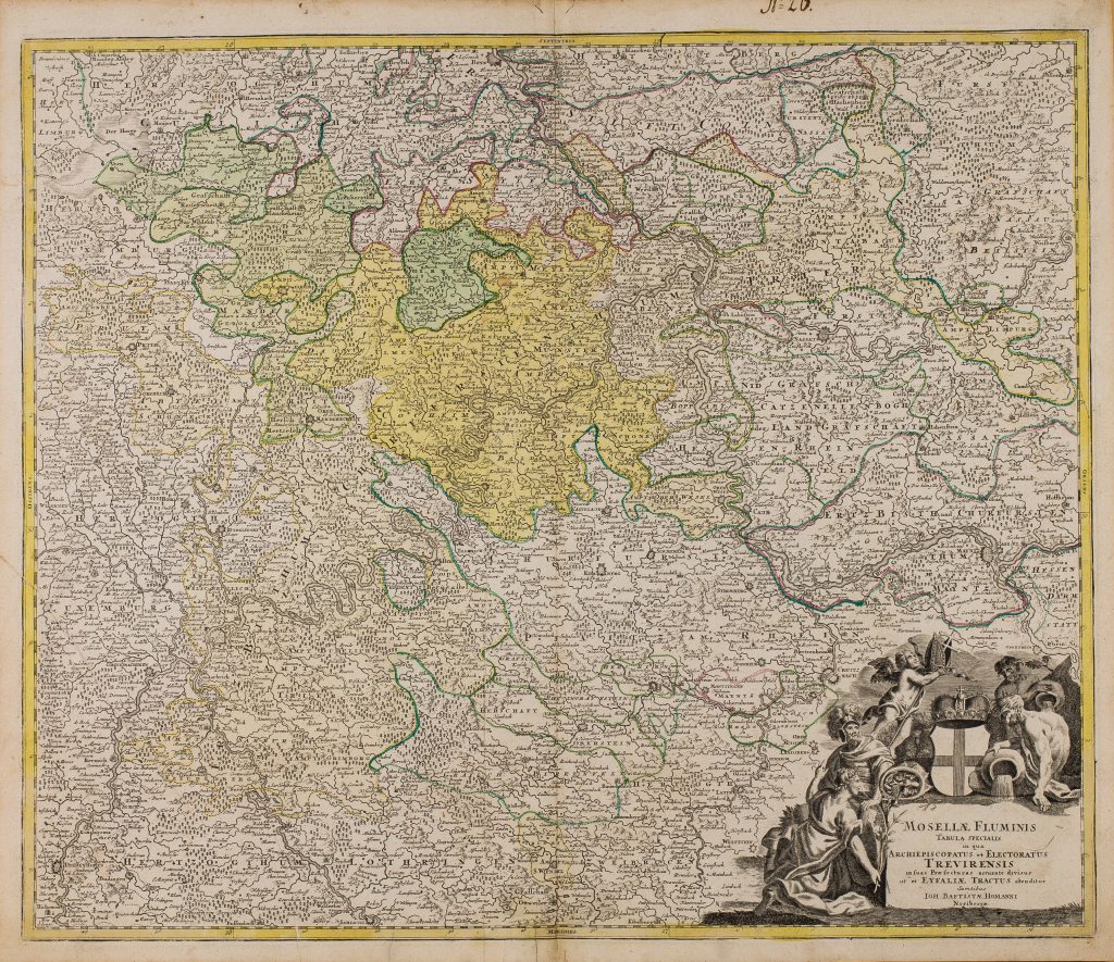
1745 Seutter, Matthäus: Trevirensis Archi-Episcopatus
Oppenheim – Brühl
Neueste Kommentare